MOJAVE NATIONAL PRESERVE, CALIFORNIA
Mojave National Preserve is a vast and diverse protected area located in the Mojave Desert of California, USA. Situated in the Mojave Desert of California, USA, Mojave National Preserve is a large and varied protected area. It is located in the southeast region of California, nestled between Interstates 15 and 40. Huge sand dunes, volcanic cinder cones, forests of Joshua trees, rugged mountains, and wide stretches of creosote bush scrub are just a few of the diverse landscapes found inside the preserve.
BASIC FACTS ON MOJAVE NATIONAL PRESERVE
LOCATION: Mojave Desert, California
SIZE: 1.6 million acres of
desert landscapes.
FOUNDED: October 31, 1994
BEST TIME TO VISIT: October through April
HOW LONG: 1-2 DAYS
ROAD TRIP SUGGESTION: California & Nevada Deserts Road Trip from Las Vegas to San Diego
NOTE: Reservations might be required to enter the park during peak seasons and/or you might need additional info about the park in order to have a smooth travel. Please VISIT HERE for latest information about the park.

RORA TRAVELS
THINGS TO DO & SEE
HIKE KELSO DUNES: (DISTANCE: 2.9 mile out & back | DIFFICULTY: Moderate | ELEVATION: 479 ft. | TIME: 1.5 hr.
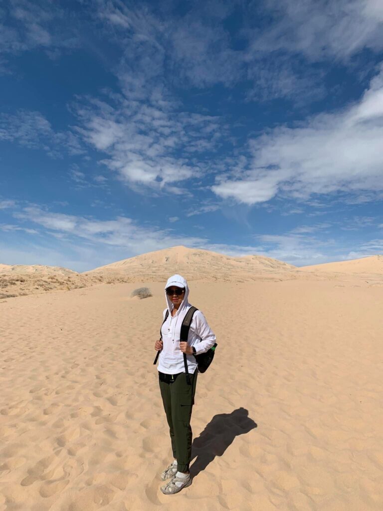
- Climb Kelso Dunes to the summit for sweeping views of the surrounding desert. The dunes are also popular for photography and sandboarding. Among the highest sand dunes in all of North America, the dunes reach heights of nearly 600 feet! So get ready for a workout if you’ve never hiked on sand before! Though difficult to reach, the summit offers a wide view over the sand dunes as compensation.

HIKE HOLE-IN-THE-WALL RING TRAIL: (DISTANCE: 1.4 mile loop | DIFFICULTY: Moderate | ELEVATION: 131 ft. | TIME: 30 mins-1 hour).
- The 1.3-mile moderate Rings Trail winds through narrow gorges with walls marked with little holes; caused by air pockets that were trapped in cooling lava that was created more than a million years ago by volcanic activity. Be prepared to rock scramble at the very end of the trail. Also, you might want to consider going through the trail in clockwise manner as this will make you climb up the rings instead of climbing down, which I think is a bit more tedious.
HIKE TEUTONIA PEAK TRAIL: (DISTANCE: 3.2 miles out & back | DIFFICULTY: Moderate ELEVATION GAIN: 659 ft. | TIME: 1.5-2 hours.
- Experience Joshua Tree woods and take in views of Cima Dome and the surrounding area by hiking the Teutonia Peak Trail.
LAVA TUBE TRAIL: (DISTANCE: |0.5 mile DIFFICULTY: Easy ELEVATION GAIN: 62 ft. | TIME: 1 hr.
- To get here, you will to go down Aiken Mine Road, which is a washboardable, sandy, and bumpy road that the National Park Service advises using a vehicle with high clearance. Once at the parking lot, you will walk on a gravel road which will lead you a short trail that will take you to the lava. You can then choose to descend the ladder to enter the lava tube after you’ve arrived. However, although hiking through the lava tube to the other side is feasible, you should not forget that you’ll need a bright source of light, such as a headlamp or flashlight and be aware that snakes can be found inside the lava tube.
CIMA DOME AND JOSHUA TREE FOREST:
- Drive to Cima Dome, a prominent area dotted with groves of Joshua trees. You can stroll about the area or enjoy beautiful views from the road. This forest is actually denser and larger than the ones in Joshua Tree National Park.
BOULDERS VIEWPOINT:
- You can see enormous stacks of stones from the stones Viewpoint. These boulder stacks have a lot of visual similarities to the landscape found in Joshua Tree National Park. For a closer look, you may take the short route or just enjoy the scenery from the parking lot.
MOJAVE CROSS:
- Explore the Mojave Cross, a memorial situated within the park. Veterans of World War I are honored by the cross.
A DAY IN MOJAVE NATIONAL PRESERVE (FROM LAS VEGAS) ITINERARY + MAP
BEFORE YOU GO:
- Make sure you download offline maps—including the official park map—before you go. There are limited cell service and GPS signals across the area.
- The only gas and service stations are located outside of the park. Make sure your vehicle has a full tank of gas before entering the park.
- Wear appropriate clothes
- Bring lots of water. Keep some in the car. Keep hydrated.
- Food and drink are not available in the preserve, so be sure to eat beforehand or pack enough food, snacks, sandwiches for great picnics, and other necessities to get you through the day!
- The majority of the paths that go to the most attractive areas of the preserve are unpaved and occasionally quite uneven. Every road is suitable for a small vehicle. No requirement for an SUV or truck
7AM-9AM:
- Drive to Mojave National Preserve.
- Head towards Cima Dome. Enjoy the abundance of Joshua trees all around you.
9AM-11AM:
- OPTION 1: Drive towards your first hike at the park; Tetunia Peak Trail. Hike to the top and enjoy the vista of the park.
- OPTION 2: If you do not want to hike Tetunia and want to save time for Kelso Dunes, go ahead to the next location; Hole-in-the-Wall Rings Trailhead. Stop by Mojave Memorial Cross on the way there, if you want to.
11AM-2PM:
- OPTION 1: After hiking Tetunia Peak, drive towards Hole-in-the Wall Rings Trailhead. You can go visit Mojave Memorial Cross on the way. Have a quick bite before you head on your excursion. Hike Hole-in-the-Wall Rings Trail.
- OPTION 2: If you skipped Tetunia Peak Trail, and already hiked Hole-in-the-Wall Trail, go to your next destination, which is Lava Tube Trail. Perfect time for a bite too.
2PM-4PM:
- OPTION 1: Drive towards Lava Tube Trailhead and hike it. If you are a super fast hiker, you might be able to drive to Kelso Dunes after Lava Tube and at least get a feel of being at the sand dunes without hiking to the top and stay for sunset. Or you might just have to skip Kelso Dunes if you think it’s getting too late and dark.
- OPTION 2: Drive towards Kelso Dunes Trailhead. Hike Kelso Dune or just take a walk at the bottom and enjoy the beauty. You can stay for sunset or move along to the next thing before it gets too dark.
4PM-6PM:
- Drive towards your next destination. Either go back to Las Vegas or maybe towards Joshua Tree National Park if you doing a “Road Trip from Las Vegas to San Diego” (maybe stop by the Boulders Viewpoint area if it’s not too late/dark yet)
Using This Map: To access the layers (driving routes and places to go), click the tab located in the upper left corner of the map. To reveal or conceal layers, click the checkboxes. You may learn more about each point of interest on the map by clicking on the icons. This map will be added to your Google Maps account if you click the star next to the map’s title. Open Google Maps on your computer or phone, select “Your Places” from the menu, then click Maps. This map will appear on your list.
